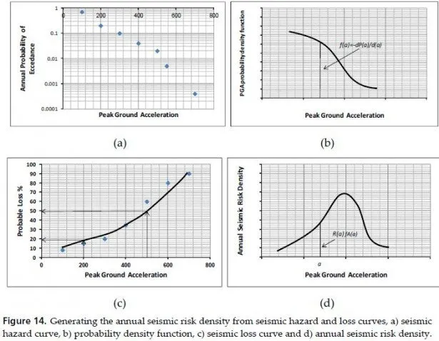
The new complex method of seismic hazard assessment that resulted in creation of the probabilistic maps of seismic microzonation is presented in this chapter. To study seismicity and analyze seismic hazard of the territory the following databases are formed:
macroseismic, seismologic databases and the database of possible seismic source zones (or potential seismic sources – PSS) as well. Using modern methods (over-regional method of IPE RAS – Russia) and computer programs (SEISRisk-3 USA) in GIS technologies there were designed some probabilistic maps of seismic hazard for the Republic North Ossetia- Alania in intensity units (MSK-64) at a scale of 1:200 000 with exceedance probability being of 1%, 2%, 5%, 10% for a period of 50 years, which corresponds to recurrence period of 5000, 2500, 1000, 500 years. Moreover, first the probabilistic maps of seismic hazard were made in acceleration units for the territory of Russia. The map of 5% probability is likely to be used for the large scale building, i.e. the major type of constructions, whereas the map of 2% probability should be used for high responsibility construction only. The approach based on physical mechanisms of the source is supposed to design the synthesized accelerograms generated using real seismic records interpretation.
For each of the zoning subject the probabilistic map of the seismic microzonation with location of different calculated intensity (7, 8, 9, 9*) zones is developed (the zones, composed by clay soils of fluid consistency, which can be characterized by liquefaction at quite strong influences, are marked by the index 9*). The maps in acceleration units show the similar results.
The complex approach based on the latest achievements in engineering seismology, can significantly increase the adequacy or foundation for assessments and reduce the inaccuracy in earthquake engineering and construction.
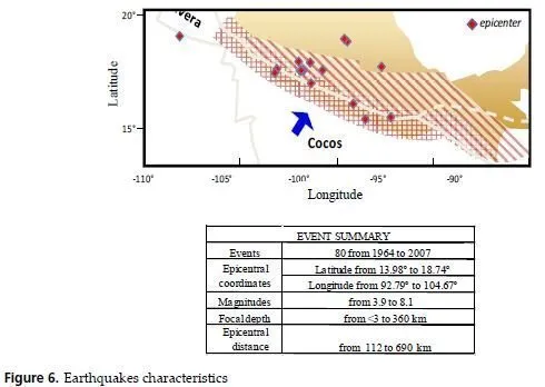
Realization of investigations on mapping of seismic hazard such as detailed seismic zoning (DSZ) based on the most advanced field research methods and analysis of every subject ofthe Northern Caucasus separately on a scale of 1:200 000 gives the possibility to merge a bit unavailable, at first glance, schemes into geologically and geophysically quite reasonable map of DSZ for the Northern Caucasus with equal scale system of the source zones.